Six Fatally Injured When Rockwell 690A Impacted Terrain
The NTSB has released its factual report in an accident which occurred November 23, 2011 that resulted in the fatal injury of six people aboard a Rockwell International (Aero Commander) 690A airplane which was destroyed when it impacted terrain in the Superstition Mountains near Apache Junction, Arizona.

The airplane was registered to Ponderosa Aviation, Inc. (PAI) and operated by PAI under the provisions of 14 Code of Federal Regulations (CFR) Part 91 as a personal flight. Night visual meteorological conditions (VMC) prevailed, and no flight plan was filed. The airplane had departed Falcon Field (FFZ), Mesa, Arizona, about 1825 and was destined for Safford Regional Airport (SAD), Safford, Arizona.
According to the report, PAI’s director of maintenance (DOM) and the director of operations (DO), who were co-owners of PAI along with the president, conducted a personal flight from SAD to FFZ. The DO flew the leg from SAD to FFZ under visual flight rules (VFR) in night VMC. After arriving at FFZ and in preparation for the flight back to SAD, the DOM moved to the left front seat to act as the pilot flying. The airplane departed FFZ about 12 minutes after it arrived. According to a witness, engine start and taxi-out appeared normal.
Review of the recorded communications between the pilot and the FFZ tower air traffic controllers revealed that when the pilot requested taxi clearance, he advised the ground controller that he was planning an "eastbound departure." The flight was cleared for takeoff on runway 4R, and the pilot was instructed to maintain runway heading until advised, due to an inbound aircraft. About 90 seconds later, when the airplane was about 1.1 miles from the departure end of the runway, the tower local controller issued a "right turn approved" advisory to the flight, which the pilot acknowledged. Radar data revealed that the airplane flew the runway heading for about 1.5 miles then began a right turn toward SAD and climbed through an altitude of about 2,600 feet mean sea level (msl). About 1828, after it momentarily climbed to an altitude of 4,700 feet, the airplane descended to an altitude of 4,500 feet, where it remained and tracked in an essentially straight line until it impacted the mountain. The last radar
return was received at 1830:56 and was approximately coincident with the impact location. The impact location was near the top of a steep mountain that projected to over 5,000 feet msl. Witnesses reported seeing a fireball, and law enforcement helicopters were dispatched.
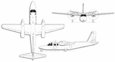
The airplane was recently purchased by PAI and was flown about 1,200 miles from Indiana to the PAI facility at SAD about 1 week before the accident. It was certificated for single-pilot operation. At the time of the accident, the airplane was configured for a pilot (left side), a copilot (right side), and five passengers.
According to the sale advertisement listing for the airplane, the airplane was equipped with very high frequency omnirange (VOR) and GPS (KLN 90B) navigation units, a radar altimeter, and an Avidyne EX-500 multifunction display, which were destroyed in the accident.
At the time of purchase by PAI, the airplane was not in compliance with an FAA required 150-hour inspection requirement, and PAI requested an FAA ferry permit to fly the airplane from Eagle Creek Airpark (EYE), Indianapolis, Indiana, to the PAI facility in Safford, Arizona. On November 16, 2011, the FAA issued a ferry permit for the relocation of the airplane. The permit was valid until arrival at SAD or November 25, 2011, whichever came first. It only permitted a direct flight between EYE and SAD and only allowed the pilot and essential crew on board. The airplane was flown by the PAI president, who was the brother of the accident pilot, from EYE to SAD on November 17, 2011. The arrival at SAD terminated the ferry permit.
PAI and FAA Scottsdale Flight Standards District Office (FSDO) personnel estimated that it would normally require two people 2 days to conduct the inspection necessary to render the airplane in compliance with the outstanding airworthiness items, exclusive of correcting any identified deficiencies. All available evidence indicated that no maintenance activity was accomplished on the airplane between its arrival at SAD and its departure to FFZ on the night of the accident; the condition that warranted the ferry permit had not been corrected.
Title 14 CFR 91.223 stated that with certain exceptions, turbine-powered, US registered airplanes configured with six or more passenger seats and manufactured before early 2002 could not be operated after March 29, 2005, unless the airplane was equipped with an approved TAWS unit.
Since the accident airplane was manufactured in 1976 and was turbine-powered, any exclusion from the TAWS requirement required that the airplane had to be configured with five or fewer passenger seating positions. According to the type certificate holder's documentation, the airplane was manufactured and delivered with six passenger seating positions. Therefore, the airplane's as manufactured configuration required the installation of TAWS by March 2005. No records indicating that the number of passenger seating positions was ever less than six before May 2005 were located. However, a detailed review of airplane maintenance records, preaccident photographs, TAWS equipment manufacturer's data, and a detailed inventory of the recovered wreckage indicated that the accident airplane was never equipped with TAWS. (The sale advertisement information for the airplane indicated that it was equipped with a KGP-560 TAWS B unit.)
Maintenance documentation indicated that in May 2005, the airplane seating configuration was changed to reduce passenger seat provisions from six to five by removing a seat belt from the aft divan, which was originally configured with seat belts for three people. Per the requirements of 14 CFR 91.223 and the reduced passenger seat count, the airplane was not required to be equipped with TAWS.
However, FAA and manufacturer/type certificate holder guidance indicated that any seating configuration changes should be approved by either the FAA or the manufacturer/type certificate holder, and examination of the maintenance documentation for the accident airplane revealed that neither requirement had been satisfied. The seating modification was not approved by the FAA or any other agency or documented either via a supplemental type certificate and/or FAA Form 337 (Major Repair and Alteration). Postaccident review of the documentation that was used to substantiate the seating configuration change revealed that the modified seating position plan was not one of the manufacturer's/type certificate holder's approved configurations. The document that was used to substantiate the change was determined to be an altered version of the manufacturer's original document, but it was incorrectly represented as a manufacturer's original document. Attempts to determine who made the improper and unauthorized
changes to the seating configuration document, or when they were made, were unsuccessful.
Neither FFZ nor SAD was equipped with a VOR ground navigation facility. Navigation between the two airports via available VOR stations would result in an indirect flight route.
The flight from SAD to FFZ and the accident flight were both conducted in VMC as VFR flights. No flight plan was filed for either flight, and neither pilot had requested air traffic control (ATC) flight following services. Available radar data and interviews with PAI personnel indicated that the pilot had flown between SAD and FFZ several times previously and that he tended to use his iPad, equipped with ForeFlight software and GPS, to fly directly between the two. The software could display FAA VFR aeronautical charts (including FAA-published terrain depiction) and overlay airplane track and position data on the chart depiction. According to the pilot's brother, the pilot's habit pattern was to depart the airport, identify the track needed to fly directly to the destination, and turn the airplane onto that track. Remnants of an iPad were found in the wreckage. Damage precluded determination of its positive association with a particular owner, its functionality, or its operational status at the time
of the accident.
Radar tracking data from the accident flight indicated that the airplane began its right turn on course to SAD about 1.5 miles northeast of FFZ. Comparison of the direct line track data from two different initial locations (FFZ, and northeast of FFZ after completion of the turn) to SAD revealed that while the direct track from FFZ to SAD passed about 3 miles south of the impact mountain, the direct track from northeast of FFZ to SAD overlaid the impact mountain location. That resulting ground track was also coincident with the accident flight radar data ground track.
In January 2008, the NTSB issued a safety alert titled "Controlled Flight Into Terrain in Visual Conditions: Nighttime Visual Flight Operations Are Resulting in Avoidable Accidents." The safety alert stated that recent investigations identified several accidents that involved CFIT by pilots operating under visual flight conditions at night in remote areas, that the pilots appeared unaware that the aircraft were in danger, and that increased altitude awareness and better preflight planning likely would have prevented the accidents.
The safety alert suggested that pilots could avoid becoming involved in a similar accident by proper preflight planning, obtaining flight route terrain familiarization via sectional charts or other topographic references, maintaining awareness of visual limitations for operations in remote areas, following instrument flight rules practices until well above surrounding terrain, advising ATC and taking action to reach a safe altitude, and employing a GPS-based terrain awareness unit.
 ANN's Daily Aero-Linx (04.16.24)

