Steep Bank Followed By 'Uncontrolled Vertical Descent'
The pilot of a Cirrus SR22 in a busy traffic pattern at Melbourne, FL, found himself with few options on his approach for runway 9R. The result was an apparent classic stall resulting from a steep turn. All three people on board the SR22 were fatally injured.

NTSB Identification: ERA12FA196
14 CFR Part 91: General Aviation
Accident occurred Wednesday, February 29, 2012 in Melbourne, FL
Aircraft: CIRRUS DESIGN CORP SR22, registration: N544SR
Injuries: 3 Fatal.
This is preliminary information, subject to change, and may contain errors. Any errors in this report will be corrected when the final report has been completed.
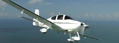
On February 29, 2012, about 1701 eastern daylight time, a Cirrus SR22 (similar aircraft pictured below), N544SR, was substantially damaged when it collided with terrain following an uncontrolled descent while maneuvering for landing at the Melbourne International Airport (MLB), Melbourne, Florida. The certificated private pilot and two passengers were fatally injured. Visual meteorological conditions prevailed, and no flight plan was filed for the local personal flight, which was conducted under the provisions of Title 14 Code of Federal Regulations Part 91.
Review of preliminary air traffic control information revealed that there were several airplanes and a helicopter in the traffic pattern at MLB, performing simultaneous operations to parallel runways, around the time of the accident. About 1658, the accident pilot contacted the MLB air traffic control tower (ATCT) from a position 5 miles south of the airport, and requested a full-stop landing. The pilot was instructed to report when the airplane was on the downwind leg of the traffic pattern for runway 9 Right (9R). Shortly after, a Cirrus SR20, which was on an approximate 5-mile final approach for runway 9R, was cleared for a touch-and-go landing. Approximately 1659, the ATCT advised the accident pilot that he would be required to extend the downwind leg for the Cirrus on final approach. The accident pilot requested a long landing on runway 9R in order to reduce taxi time to the fixed-base operator (FBO), and the ATCT cleared the accident airplane for landing on runway 9R.
At 1700:50, the ATCT radioed the accident pilot to confirm that he had visual contact with the Cirrus SR20 on a one-mile final for runway 9R. The accident pilot replied that he was on a “real short base” for runway 9R. The ATCT then instructed the accident pilot to “cut it in tight” to runway 9R. Several witnesses described the airplane as it entered a steep bank, followed by a vertical, uncontrolled descent. The airplane disappeared from view into wooded terrain short of runway 9R.
The airplane was examined at the accident site and all major components were accounted for at the scene. An odor of fuel was present at the site. The wreckage closely surrounded the initial impact crater. The engine compartment, firewall, instrument panel, cockpit, and cabin areas were all destroyed by impact. The empennage and tail section remained largely intact. Control cable continuity was established from the flight control surfaces in the tail to the cockpit area. Control cable continuity could not be established to the control surfaces in the wings due to multiple cable breaks; however, all cable breaks displayed signatures consistent with overload failure. The three-bladed propeller was buried in the crater, and separated from the engine. One blade was found separated, and two blades remained in the hub. All three blades displayed similar aft bending, leading edge gouging, polishing, and chordwise scratching.
The Cirrus Airframe Parachute System (CAPS) parachute was found deployed, and entangled in the wreckage. Witness statements, and the location of the CAPS components were consistent with a low-altitude deployment.
An Avidyne Primary Flight Display (PFD),Multifunction Flight Display (MFD), and the airplane's Electronic Ground Proximity Warning System (EGPWS) were recovered from the wreckage and forwarded to the NTSB Recorders Laboratory in Washington, DC.
The 1653 recorded weather observation at MLB included wind from 140 degrees at 14 knots gusting to 20 knots, clear skies, 10 miles of visibility, temperature 24 degrees C, dew point 20 degrees C, and an altimeter setting of 30.11 inches of mercury.
 ANN's Daily Aero-Linx (04.13.24)

