Mountain Flying Requires Special Considerations
The FAA and the general aviation (GA) community’s national #FlySafe campaign helps educate GA pilots about the best practices to calculate and predict aircraft performance and to operate within established aircraft limitations.
A Loss of Control (LOC) accident involves an unintended departure of an aircraft from controlled flight. LOC can happen when the aircraft enters a flight regime that is outside its normal flight envelope and quickly develops into a stall or spin. It can introduce an element of surprise for the pilot.
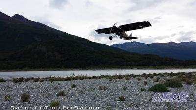
Mountain flying can be an exhilarating adventure. However, maintaining safety in this kind of environment requires a pilot to stay alert and pay attention. Knowing the weather, how to read the clouds, making your flight plan, and staying out of trouble … these points are all key to enjoying another day.
Every mountainous area is different, so while you might be familiar with one area, you are likely not prepared for all. Good training, both on the ground and with an experienced flight instructor, will help ensure that you know the basics of mountain flying and understand the different types of hazards you may encounter.
Here are some general weather guidelines you’ll want to keep in mind when mountain flying:
- Winds forecast at 9,000 and 12,000 feet at a maximum of 25 knots.
- Ceiling at least 2,000 feet above all ridges and passes along the route.
- Visibility of at least 10 miles along the route.
If any of these requirements are not met, look for an alternative route, consider delaying the flight, or cancel the flight and rent a car. Be smart and stay safe!
When the wind speed is above about 25 knots and flowing perpendicular to a ridge line, the air flow can form waves, much like water flowing over rocks in a stream bed. These “mountain” or “lee” waves can occur in any season, but are more common in the winter. Mountain waves can cause very strong up- and downdrafts. The downdrafts in moderate mountain waves can exceed 1,000 feet per minute, making it difficult to cross the ridge.
Severe turbulence can also develop with the rotor that comes with a mountain wave. Rotors are caused by wind shear and rotating movement underneath the crest of a mountain wave.
A good mountain flying course should include a thorough discussion on how to read the clouds. You’ll learn how to spot the crests of a mountain wave and identify rotor clouds. Knowing these basics will help you choose the best route for a safe flight.
Density altitude is the pressure altitude corrected for temperature. The important take-away for a pilot here is that density altitude is an indicator of aircraft performance. The term comes from the fact that the density of the air decreases with altitude. A “high” density altitude means that air density is reduced, which has an adverse impact on aircraft performance.
You must know how your aircraft will perform in a variety of density altitudes. The numbers can vary and will change quickly. Elevation, snow melt, and other factors will all affect density altitude. Know how your aircraft will respond. Normally-aspirated engines develop approximately three-percent less power for each thousand feet above sea level.
You’ll want to lean your engine for higher density altitudes. Leaning will ensure the maximum power output from your engine, as well as reduce sparkplug fouling during idle and taxi operations. It is recommended to lean when taxiing or any time the engine is operating above approximately 3,500 feet mean sea level.
Also, know that your true airspeed is about two percent higher than indicated airspeed for every thousand feet of altitude. The greater speed results in a greater turn radius. The higher true airspeed also translates into a longer landing roll, so keep that in mind during your touchdown. You may have 20 percent more speed than you would at sea level, which is comparable to landing with a tailwind. The ground will appear to rush by faster than what you are accustomed to. Override your instincts and fly the airplane based on its indicated airspeed.
Planning a mountain flight involves finding points in space, not predefined intersections. You will be looking for terrain features, such as passes and drainage. Use global positioning system waypoints in conjunction with a mobile device application to maintain situational awareness and avoid getting lost. A good mountain flying course will teach you how to select routes that will keep you safe.
Some states produce tools to help pilots navigate safely. Check your state’s Department of Aeronautics for helpful charts, maps, and phone numbers.
Finally…
- Know your weather, and know when to delay your flight.
- Know your aircraft’s performance ranges and limits.
- Before descending into a mountain airport, know your options for go-arounds and take-offs.
- Never fly up a canyon that you haven’t already flown down, so that you know there is room to turn around.
- Never try to out climb the terrain. Many pilots have lost that bet.
- Do your preflight planning, so you’ll know the correct heading to expect when picking the right valley to fly through.
- If an accident happens, stay with the airplane. Remove the ELT from the aircraft, turn it on, and let your rescuers turn it off.
- Finally, take a good mountain flying course before venturing out. Fly regularly with a flight instructor who will challenge you to review what you know, explore new horizons and always do your best.
Contributing factors to Loss of Control may include:
- Poor judgment or aeronautical decision making
- Failure to recognize an aerodynamic stall or spin and execute corrective action
- Intentional failure to comply with regulations
- Failure to maintain airspeed
- Failure to follow procedure
- Pilot inexperience and proficiency
- Use of prohibited or over-the-counter drugs, illegal drugs, or alcohol
(Source: FAA news release. Image from file)
 ANN's Daily Aero-Linx (04.15.24)

