Tue, Jan 11, 2005
Putting The Third Dimension In 3D
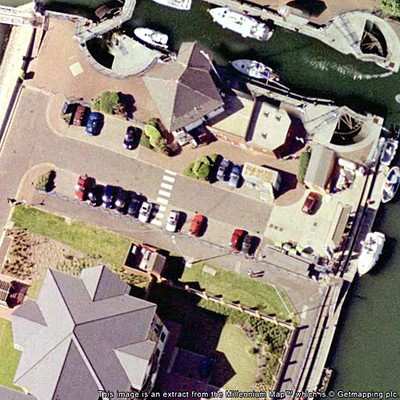
 Aerial mapping company BlueSky
Monday launched Point-Z, a national database of land and building
height measurements that holds the height above sea level for any
given point in Great Britain. Point-Z comprises a grid of billions
of survey points collected every 5 meters or less using
sophisticated remote sensing technology. Height accuracy varies
from less than 1 meter to as little as 5 centimeters for selected
areas such as high-risk flood plains and coastal zones.
Aerial mapping company BlueSky
Monday launched Point-Z, a national database of land and building
height measurements that holds the height above sea level for any
given point in Great Britain. Point-Z comprises a grid of billions
of survey points collected every 5 meters or less using
sophisticated remote sensing technology. Height accuracy varies
from less than 1 meter to as little as 5 centimeters for selected
areas such as high-risk flood plains and coastal zones.
Point-Z data has many applications from civil engineering, flood
risk assessment, and quarrying to mobile network planning, railway
engineering and personal navigation. The Point-Z database is
revolutionary as it is based entirely upon data collected by remote
sensing. It replaces traditional contour maps drawn from costly and
time consuming land surveying work. Point Z data creates a much
more accurate contour map captured electronically using remote
sensing.
Most notable in the Point-Z database is NEXTMap Britain, a new
terrain map of the whole of Great Britain created by Intermap
Technologies. This groundbreaking national mapping project took
only two years to complete and involved a Learjet specially
equipped with a highly accurate Radar sensor flying at night at an
altitude of over 20,000 ft to scan the land with unprecedented
accuracy.
Additional Point-Z data is derived from other remote sensing
methods such as aerial photography and LIDAR (Light Detection and
Ranging), which is used for areas where centimeter accuracy is
required. The standard format is an XYZ text file, but other
formats for more experienced users across a range of software are
also available. Every individual point in the Point-Z database will
be tagged to provide information (meta data) about the grid
spacing, height accuracy, date, acquisition method, copyright and
whether it is an bald earth indicator or a first surface height for
features such as trees or buildings.
Elevation points may be used in isolation but their real value
lies in providing the 3rd dimension in maps when viewed as contours
or with software to create cross sections and most spectacularly
real world visualizations and fly-throughs when matched to aerial
photography. These 3D landscapes and cityscapes, can be modelled to
reflect proposed development such as new buildings, roads and
quarries as a useful aid for planners, architects and civil
engineers. Applications for road vehicle telemetry and synthetic
vision for fog bound aircraft are also being developed.
More News
Inversion to Launch Reentry Vehicle Demonstrator Aboard SpaceX Falcon 9 This fall, the aerospace startup Inversion is set to launch its Ray reentry demonstrator capsule aboard Spac>[...]
"We are excited to accelerate the adoption of electric aviation technology and further our journey towards a sustainable future. The agreement with magniX underscores our commitmen>[...]
"The journey to this achievement started nearly a decade ago when a freshly commissioned Gentry, driven by a fascination with new technologies and a desire to contribute significan>[...]
Aero Linx: OX5 Aviation Pioneers Each year a national reunion of OX5 Aviation Pioneers is hosted by one of the Wings in the organization. The reunions attract much attention as man>[...]
"Our driven and innovative team of military and civilian Airmen delivers combat power daily, ensuring our nation is ready today and tomorrow." Source: General Duke Richardson, AFMC>[...]
 SpaceX to Launch Inversion RAY Reentry Vehicle in Fall

