Global Hawks Study West Coast Winter Storms
NOAA scientists will use unmanned aircraft to study
“rivers in the sky” during the Winter Storms and
Pacific Atmospheric Rivers, or WISPAR, field campaign slated to
begin Feb. 11. The focus of the research is to improve our
understanding of how atmospheric rivers form and behave, and to
evaluate the operational use of unmanned aircraft for investigating
these phenomena.
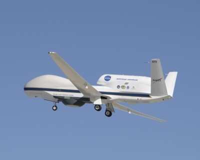
NASA WISPAR Global Hawk Photo Used With
Permission
Atmospheric rivers, or ARs, are narrow regions in the atmosphere
that transport large amounts of water vapor across the Pacific and
other regions. In one day, an average AR transports an amount of
water vapor equivalent to a foot of liquid water covering 10
million acres — an area roughly the size of Maryland. This is
about seven times the average daily flow of water from the
Mississippi River into the Gulf of Mexico. Only a portion of the
water vapor transported by an AR is transformed into rain or snow;
for example, about 20-40 percent in one AR crossing northern
California makes it to the surface. The importance of ARs was
recently highlighted in a major emergency preparedness scenario led
by the U.S. Geological Survey that focused on the possibility of a
series of strong ARs striking California. That scenario showed that
resulting flooding, wind and even mudslides could exceed damages
brought on by Hurricane Katrina in 2005.
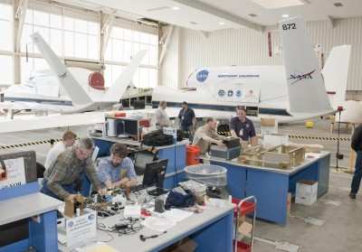
NASA WISPAR Hangar Photo Used With Permission
Results from WISPAR will include demonstration of new
technology, contributions to the science of ARs, and, through
collaborations with NOAA’s Winter Storms Reconnaissance
Program — started by the National Weather Service in 1999 to
collect observations to improve winter storm forecasts — the
potential of offshore monitoring of ARs to aid in weather
predictions. While ARs are responsible for great quantities of rain
that can produce flooding, they also contribute to beneficial
increases in snowpack. A series of atmospheric rivers fueled the
strong winter storms that battered the U.S. West Coast from western
Washington to southern California from Dec. 10-22, 2010, producing
11 to 25 inches of rain in certain areas. The ARs also contributed
to the snowpack in the Sierras, which received 75 percent of its
annual snow by Dec. 22, the first full day of winter. “We
need to know more so we can better predict the exact timing,
location and amounts of precipitation,” said Marty Ralph,
head of the Water Cycle Branch at NOAA’s Earth System
Research Laboratory in Boulder, Colo. “Although we have been
studying atmospheric rivers since 2003, there are still things to
be learned about the fate of ARs in a changing climate, such as do
they get stronger or weaker, do they occur more or less
frequently?”
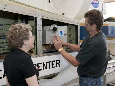
(L-R) NOAA's Laurel Watts, NASA's Dennis Pitts NASA Photo
Used With Permission
NASA’s Global Hawk, which is operated by NASA’s
Dryden Flight Research Center in southern California, will be
equipped with sensors including an advanced water vapor sensor
— the high-altitude monolithic microwave integrated circuit
sounding radiometer, or HAMSR — created by NASA’s Jet
Propulsion Laboratory in Pasadena, CA, and a new dropsonde funded
by NOAA and developed by the National Center for Atmospheric
Research in Boulder, CO. The dropsondes will be launched from the
Global Hawk and take temperature, wind and other readings as they
descend through an AR. Unmanned aircraft are being used in a
variety of scientific studies because they are able to fly long
distances, stay aloft for more than 24 hours and can travel at high
and low altitudes that could be dangerous for humans.
 ANN's Daily Aero-Linx (04.17.24)

