Landing A B757 At 9,700 Feet | Aero-News Network
Aero-News Network
RSS icon RSS feed
podcast icon MP3 podcast
Subscribe Aero-News e-mail Newsletter Subscribe

Airborne Unlimited -- Most Recent Daily Episodes

Episode Date

Airborne-Monday

Airborne-Tuesday

Airborne-Wednesday Airborne-Thursday

Airborne-Friday

Airborne On YouTube

Airborne-Unlimited-04.01.24

Airborne-Unlimited-04.09.24

Airborne-Unlimited-04.10.24 Airborne-Unlimited-04.11.24

Airborne-Unlimited-04.12.24

Join Us At 0900ET, Friday, 4/10, for the LIVE Morning Brief.
Watch It LIVE at
www.airborne-live.net

Tue, Oct 24, 2006

Landing A B757 At 9,700 Feet

New Navigation System Takes Pilots On Wild Ride

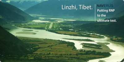
One of the highest airports in the world has been virtually unreachable by commercial airlines --until now. An Air China Boeing 757 has been testing a new navigational system developed by Seattle-based Naverus Systems.

At 9,700 feet, Linzhi airport in Tibet lies not only one-third as high as nearby Mount Everest, but is virtually hidden year round by constant clouds and is of course, surrounded by very high mountains.

Naverus, has developed an automated navigation system, using GPS and inertial on-board instruments to automatically guide the aircraft through the mountain ranges and into a twisting valley that is the only possible approach into Linzhi.

The Seattle Times reports Chinese aviation authorities are deploying the Naverus system -- a sophisticated version of technology that's broadly known as Required Navigation Performance (RNP).

You can't just plug the box in and go, though. Naverus had to design the approaches into Linzhi after months of gathering data about the airport, the surrounding terrain, weather conditions, the 757's performance, its flight-deck systems, the airline's training procedures and government regulations.

Pilots marvel as the plane descends, turns, twists, and maneuvers -- all automatically -- and then presents a perfect final approach for the last 500 feet.

Capt. Chen Dong Cheng, an Air China pilot rode as an observer on the inaugural flight. He said the approach into Linzhi by a large passenger jet would be completely impossible, without the sophisticated navigational maneuvering the Naverus system offers.
He calls it, "the future of the aviation navigation industry."

The Naverus system must be pre-programmed for each specific airport and so far is only installed on Boeing 757s, but the precise navigational technology involved may make navigation for more conventional approaches even safer and more precise.

"We are making impossible things possible," Capt. Chen said.

FMI: www.naverus.com

Advertisement

More News

ANN's Daily Aero-Linx (04.13.24)

Aero Linx: Florida Antique Biplane Association "Biplanes.....outrageous fun since 1903." That quote really defines what the Florida Antique Biplane Association (FABA) is all about.>[...]

ANN's Daily Aero-Term (04.13.24): Beyond Visual Line Of Sight (BVLOS)

Beyond Visual Line Of Sight (BVLOS) The operation of a UAS beyond the visual capability of the flight crew members (i.e., remote pilot in command [RPIC], the person manipulating th>[...]

Airborne 04.09.24: SnF24!, Piper-DeltaHawk!, Fisher Update, Junkers

Also: ForeFlight Upgrades, Cicare USA, Vittorazi Engines, EarthX We have a number of late-breaking news highlights from the 2024 Innovation Preview... which was PACKED with real ne>[...]

Aero-News: Quote of the Day (04.14.24)

“For Montaer Aircraft it is a very prudent move to incorporate such reliable institution as Ocala Aviation, with the background of decades in training experience and aviation>[...]

ANN's Daily Aero-Term (04.14.24): Maximum Authorized Altitude

Maximum Authorized Altitude A published altitude representing the maximum usable altitude or flight level for an airspace structure or route segment. It is the highest altitude on >[...]

blog comments powered by Disqus


Advertisement

Advertisement

Podcasts

Advertisement

© 2007 - 2024 Web Development & Design by Pauli Systems, LC